| Description |
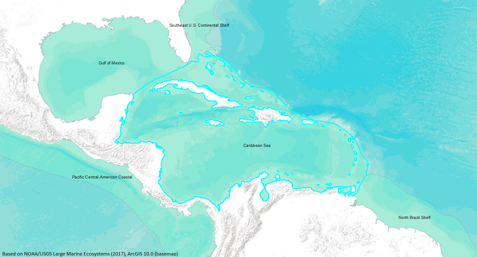
The Caribbean Sea is the second largest sea in the world. It is located in the Western Hemisphere between North and South America; 61 degrees West longitude on the east, 89 degrees West on the west, 22 degrees North latitude on the north, and 8 degrees North on the south. It encompasses an area of 2,515,900 square kilometers. It is noted for many islands, including the Leeward and Windward Islands on the eastern boundary, Cuba and Hispaniola to the north, Jamaica and Cayman Islands in the northwest, and additional continental islands in the south. In addition, there are numerous banks and breaking shoals surrounding the basin.
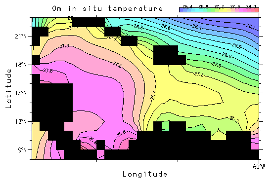
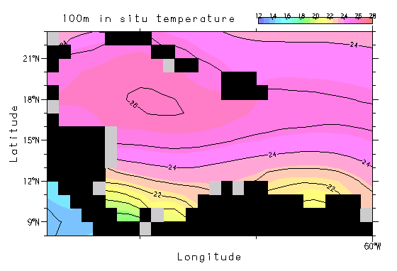
The Caribbean is comprised of four deep basins: Venezuelan Basin in the east, which is partially separated by a ridge from the Columbian Basin in the west, the Cayman Trough in the northwest (in between Jamaica and Honduras), and the Yucatan Basin north of the Cayman Trough. It is marked by narrow and relatively shallow entrances, with the Yucatan Channel the only one greater than 1,800 meters. Half of the water in the LME is deeper than 3,600 meters, and 75% is deeper than 1,800 meters (Richards and Bohnsack, 1990). The trade winds strongly influence the circulation, which is generally a westward flowing surface current with some upwelling along the South American continent. There is not much seasonal variation in surface water temperatures, which range from 25.5 degrees Celsius in the winter to 28 degrees Celsius in the summer.
Nearby areas with similar marine fauna include the Bahamas, Gulf of Mexico, Straits of Florida, Bermuda to the north, and the northern coast of South America to the mouth of the Amazon River to the east. There is good background information available on this area thanks to a multidisciplinary study called the Cooperative Investigations in the Caribbean Sea and Adjacent Areas (CICAR), completed during the 1970’s (Richards and Bohnsac, 1990) (http://www.na.nmfs.gov/lme/text/lme12.htm). |